 |
Bonn, Germany (SPX) Jan 15, 2010 There are isolated weather events that prevent even TerraSAR-X from obtaining a clear view of the surface of Earth. This TerraSAR-X image shows a thunderstorm cell with exceptionally strong rainfall off the Caribbean coast of Panama, visible at the top of the image as a blurred area. Radar always delivers a decisive advantage because it is able to take images of the surface of the Earth under virtually any weather conditions. Optical systems can only achieve this when visibility is clear - unobstructed by fog and cloud cover. To generate images, both sensors use electromagnetic waves. The ability to penetrate cloud cover depends on the wavelength employed - the longer the wavelength, the greater this capability. The microwave pulses from TerraSAR-X have a wavelength of approximately three centimetres and are normally able to penetrate a cloud ceiling without any difficulty. In contrast to this, optical sensors operate in the infrared or visible range of the electromagnetic spectrum - that is, with wavelengths which are anything up to 30,000 times shorter, at the scale of microns or even nanometres. This radiation is reflected back by clouds, meaning that the surface of the Earth below those clouds cannot be observed. Some regions of Earth, such as areas of tropical rainforest, are under continuous cloud cover, meaning that they can never be mapped completely using optical devices. The detection of precipitation on the TerraSAR-X image shown here can be explained by the fact that particles of precipitation (that is: rain, hail, snow and ice crystals) are reflecting back the radar signals, and by the fact that the volume of precipitation causes a loss in signal intensity. When the loss of signal strength caused by precipitation becomes dominant, some areas are then 'shadowed' - that is, entirely obscured from view. The bright and veiled areas are the ones facing the radar and are indicative of the effect of reflection caused by the rain 'cell'. The areas above this, shown in dark blue and black, are facing away from the radar - in these areas, the shading effect is dominant. The scene recorded here extends over an area of about 18 by 64 kilometres and was generated in dual-polarisation mode, a method that substantially increases the information content of an image. The colours are created by superimposing two separate images (red and green) of the same area taken simultaneously in this mode using two signals of different polarisation settings, together with a third image (blue) which is calculated from the difference between the original images. Now, the different reflection mechanisms become visible - the green colouration indicates a surface reflection, where the radar signal is being reflected straight back to the antenna. Red tones indicate a double reflection, and there is virtually no indication of this in the scene depicted here, since it occurs primarily in urban areas. Blue tones can be seen in the area of the thunderstorm cell, and are designated as 'volume scatter' because the signal is reflected back to the radar antenna by a multiplicity of individual raindrops and hailstones. It only becomes possible to penetrate the thunderstorm cell depicted here at substantially greater wavelengths - for example, twenty centimetres. To achieve this, radar systems that operate in the L-Band at 1.5 Gigahertz are needed - a weather event of this kind would pose no problems to equipment of this type.
Meteorological information Ground-based precipitation radars are, for the most part, only available in industrialised regions. In contrast to this, radar systems like TerraSAR-X can deliver images from anywhere in the world. In the same way as weather radar, the meteorological information obtained using this method can serve as an important input parameter for global climate models.
Share This Article With Planet Earth
Related Links German Aerospace Center (DLR) Earth Observation News - Suppiliers, Technology and Application
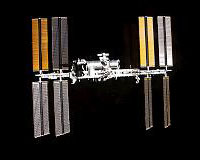
 Europe offers space station as platform for climate science
Paris (AFP) Jan 14, 2010 The European Space Agency is looking at proposals for using the International Space Station as a platform for climate science, ESA Director General Jean-Jacques Dordain said on Thursday. Seventeen proposals so far have been received "from the climate change community" for using the ISS as a basis for study, Dordain told a press conference. The "call for ideas" issued by the 18-nation age ... read more |
|
| The content herein, unless otherwise known to be public domain, are Copyright 1995-2009 - SpaceDaily. AFP and UPI Wire Stories are copyright Agence France-Presse and United Press International. ESA Portal Reports are copyright European Space Agency. All NASA sourced material is public domain. Additional copyrights may apply in whole or part to other bona fide parties. Advertising does not imply endorsement,agreement or approval of any opinions, statements or information provided by SpaceDaily on any Web page published or hosted by SpaceDaily. Privacy Statement |