 |
Bonn, Germany (SPX) Aug 17, 2010 Satellite data is an indispensable tool for quickly assessment of the situation in cases of natural or environmental disasters and for guiding emergency teams on ground. DLR's 'Center for Satellite Based Crisis Information' and many other international organizations have been using the German radar satellite TerraSAR-X for three years to rapidly obtain reliable data in all weather conditions for such crisis situations. Now, our new satellite, TanDEM-X, has also provided assistance for the first time in a crisis - gathering information on the flood catastrophe in Pakistan. We were able to help not only with radar images but we also used TanDEM-X for interferometry in formation with TerraSAR-X for the first time. This has provided a more reliable technique to map floods instantaneously and more accurately, in one pass and without the need for archived data. Radar imaging is a well-established tool for distinguishing smooth surfaces, which appear dark in radar data, from the rougher, brighter surroundings. This characteristic of radar can be used to detect an area flooded with calm water or to identify oil spills - where the water surface is flat, in contrast to the wind-induced ripples on the unpolluted sea surface. However, apart from calm water, fields or streets may also appear dark in radar images. To add to the confusion, water can also appear very bright if strong currents agitate the surface. Accurate mapping of flooded areas therefore requires a lot of expertise and pre-disaster data from the archives for comparison. But there are additional techniques to support this task, which are now possible with TanDEM-X. When the twin satellites TerraSAR-X and TanDEM-X fly over the same area within three seconds of one another, they 'see' nearly the same radar reflections from the ground, although not quite. Normally, only the terrain variations lead to small differences. These can be processed interferometrically to derive digital elevation models (DEMs). But even in these three seconds, some things change for the sensitive radar signals - these signals have a wavelength of only three centimetres. In particular, the radar backscatter from water surfaces or leaves moving in the wind show significant differences on these small scales. This effect leads to phase noise in the interferograms, referred to as incoherence. The two satellites simply don't see the same image. Within two months, when the two satellites reach their close formation, these differences will largely disappear. What is now a sometimes-annoying disturbance for DEM generation nevertheless carries a large amount of information on the scene. The degree of coherence between the two images directly reveals where the land is not completely covered by water since enough signals are being reflected from objects like rocks, buildings or trees to maintain coherence. Although TanDEM-X is not fully calibrated yet and its commissioning phase is packed with tests and experiments, the idea to use TanDEM-X to help during this crisis was seized by the commissioning team immediately and put into action. The TanDEM-X formation was used to supplement one of ZKI's planned TerraSAR-X acquisitions over Pakistan with a TanDEM-X acquisition and the data was processed interferometrically. The images show a segment from a longer stripmap data acquisition, with the city of Dera Ismail Khan visible as a bright spot beside the river. The radar brightness data image, where the built-up areas are clearly visible contrasting with the large dark areas, is shown on the left. Strong river currents also appear bright in this image. The image in the centre shows the interferometric phase difference between TanDEM-X and TerraSAR-X - incoherent areas are noisy. These areas are coloured blue in the image to the right, indicating possibly flooded areas. There is a significant discrepancy in the top left region, where dark areas surround the cities. Nevertheless, this region is obviously not completely flooded, since there is coherence in this area. The magnified view of this region below shows that some fields are partly above water level. The interferometric TanDEM-X data were provided to the ZKI for mapping support within hours. The TanDEM-X team hopes that this kind of crisis assistance will not be needed often - but, if required, the team and the technique are ready.
Share This Article With Planet Earth
Related Links TanDEM-X Earth Observation News - Suppiliers, Technology and Application
 NASA Releases New Image Of Massive Greenland Iceberg
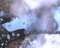
Pasadena CA (JPL) Aug 16, 2010 On Aug. 5, 2010, an enormous chunk of ice, about 251 square kilometers (97 square miles) in size, or roughly four times the size of Manhattan, broke off the Petermann Glacier along the northwestern coast of Greenland. The Petermann Glacier lost about one-quarter of its 70-kilometer-long (40-miles) floating ice shelf, according to researchers at the University of Delaware, Newark, Dela. The ... read more |
|
| The content herein, unless otherwise known to be public domain, are Copyright 1995-2010 - SpaceDaily. AFP and UPI Wire Stories are copyright Agence France-Presse and United Press International. ESA Portal Reports are copyright European Space Agency. All NASA sourced material is public domain. Additional copyrights may apply in whole or part to other bona fide parties. Advertising does not imply endorsement,agreement or approval of any opinions, statements or information provided by SpaceDaily on any Web page published or hosted by SpaceDaily. Privacy Statement |