 |
Leicester, UK (SPX) Dec 06, 2010 Earth observation scientists at the University of Leicester have recorded stunning images of the UK's winter landscape by orbiting satellites. European Space Agency satellite instruments have been observing the icy blast in the UK from their vantage points in space. Leicester scientists have used two instruments, MERIS and AATSR, which have returned stunning images of a snow-bound UK from observations on November 29th and December 1st. In the MERIS images, the colour scale runs from white snow and clouds to green vegetation. In the AATSR images, the non-snow areas are coloured red to highlight differences to the white snow. The change in snow cover within two days is clearly visible. The AATSR instrument has been funded in the UK by the Department for Energy and Climate Change, and is a centrepiece of a new exhibition at the Science Museum, entitled 'Atmosphere ... exploring climate science'. Professor John Remedios, Head of Earth Observation Science at the University of Leicester, said "These images demonstrate how much our local climate depends on a combination of the climate mean temperature in a given month and the meteorological variability which can produce very cold and very warm months. For the UK, it is another cold winter. At one time a few years ago our children complained that there was never any snow. Now there is plenty!" He added "Each year we need to make careful observations in order to increase the accuracy of the weather prediction. The AATSR instrument is both very good at measurements for climate and for weather forecasting" The AATSR instrument is flown on the European Space Agency (ESA) satellite, Envisat, launched in 2002, alongside ESA's MERIS instrument. The AATSR measures fundamental climate variables such as sea and land surface temperature, aerosols and clouds whilst the MERIS instrument is able to observe vegetation greenness and ocean colour, and their change over the seasons. The Envisat recently underwent a controlled orbit change to extend its lifetime to 2013. The images show that the instruments are working very well.
Share This Article With Planet Earth
Related Links University of Leicester Earth Observation News - Suppiliers, Technology and Application
 ASU Researcher Uses NASA Satellite To Explore Archaeological Site
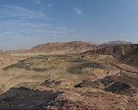
Tempe AZ (SPX) Dec 06, 2010 Remote sensing has been integral to the field of archaeology for many years, but Arizona State University archaeologist Stephen H. Savage is literally taking the use of that technology to new heights. His brand of remote sensing involves a hyperspectral instrument called Hyperion aboard NASA's Earth Observing-1 satellite. Savage's focus is Khirbat en-Nahas, a major copper mining and smelti ... read more |
|
| The content herein, unless otherwise known to be public domain, are Copyright 1995-2010 - SpaceDaily. AFP and UPI Wire Stories are copyright Agence France-Presse and United Press International. ESA Portal Reports are copyright European Space Agency. All NASA sourced material is public domain. Additional copyrights may apply in whole or part to other bona fide parties. Advertising does not imply endorsement,agreement or approval of any opinions, statements or information provided by SpaceDaily on any Web page published or hosted by SpaceDaily. Privacy Statement |