 |
Washington DC (SPX) Dec 07, 2009 NOAA officially deactivated its Geostationary Operational Environmental Satellite-10 after 12 years of service. GOES-10 tracked some of the most memorable tropical cyclones in history, including Hurricane Mitch, which devastated parts of Central America in 1998; and Hurricane Katrina, which ravaged the Gulf Coast in 2005. NOAA anticipated the end of service for several months and began deactivating GOES-10 yesterday, when it fired the spacecraft's booster moving the satellite into an orbit approximately 22,186 miles above the Earth. The agency finished its third, and final, firing of the booster putting it safely out of commission. Launched in April 1997, GOES-10 was originally planned for a five-year mission. It was positioned as NOAA's GOES-West satellite, more than 22,000 miles above the Earth's surface. In 2006, a newer satellite, GOES-11, replaced GOES-10. NOAA then repositioned GOES-10 to support hurricane forecasting efforts in South America. NOAA anticipates moving GOES-12 to provide coverage for South America by May 2010. "GOES-10 has served America - and other nations - admirably and well beyond its expected lifespan," said Mary Kicza, assistant administrator for NOAA's Satellite and Information Service. "The success of GOES-10, built by Space Systems/Loral, was a credit to a large team of NOAA staff and contractors, who acquired and managed the spacecraft and processed and distributed the data to users." Kicza added that with the help of its partners, including NASA, "NOAA is creating better satellites that will provide better data that improve our understanding - and prediction - of climate and weather." Currently, NOAA has four GOES in space: GOES-11 and GOES-12, which are in operation; GOES-13, in orbital storage and slated to replace GOES-12 when it is repositioned; and GOES-14, which launched this spring and is undergoing post-launch tests. NOAA is planning the next-generation GOES-R series, set to begin launching in 2015. GOES-R is expected to double the clarity of today's GOES imagery and provide at least 20 times more atmospheric observations than current capabilities. NOAA understands and predicts changes in the Earth's environment, from the depths of the ocean to the surface of the sun, and conserves and manages our coastal and marine resources. Share This Article With Planet Earth
Related Links NOAA Earth Observation News - Suppiliers, Technology and Application
 ESA To Attend COP15 Climate Conference
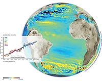
Copenhagen, Denmark (ESA) Dec 07, 2009 Government representatives from around the world will gather at the UN Climate Change Conference in Copenhagen, Denmark, 7-18 December, to negotiate a deal to restrict emissions of heat-trapping gases that drive climate change. ESA will attend the conference - also known as COP15 as it will be the 15th Conference of the Parties to the UN Framework Convention on Climate Change (UNFCCC) ... read more |
|
| The content herein, unless otherwise known to be public domain, are Copyright 1995-2009 - SpaceDaily. AFP and UPI Wire Stories are copyright Agence France-Presse and United Press International. ESA Portal Reports are copyright European Space Agency. All NASA sourced material is public domain. Additional copyrights may apply in whole or part to other bona fide parties. Advertising does not imply endorsement,agreement or approval of any opinions, statements or information provided by SpaceDaily on any Web page published or hosted by SpaceDaily. Privacy Statement |