 |
Greenbelt MD (SPX) Aug 16, 2010 Tropical Depression Five (TD5) may not be a tropical depression anymore, but NASA's TRMM satellite has noticed that its remnant low pressure circulation is making for a very bad and wet Friday the 13th for residents from southeastern Louisiana east to the Florida panhandle. Even when a tropical system gets downgraded into a low pressure area, there is still the possibility of inland flooding from heavy rainfall, and that's what this low is creating. The Tropical Rainfall Measuring Mission (TRMM) has been called a "rain gauge in space" and can provide accurate measurements of rainfall in tropical and sub-tropical areas around the world. TRMM data, along with information from other satellites, allows researchers to see how much rain is falling over most of the world every three hours and map areas of potential flooding. Maps that show areas of potential floods use precipitation radar data and high resolution measurements of water content of clouds made by microwave radiometers. Those rainfall maps were made into a nine day "movie loop" that allows users to track storms as they travel over land and oceans around the globe. The rainfall animations are developed in the Laboratory for Atmospheres of the NASA Goddard Space Flight Center, Greenbelt, Md. by the TRMM precipitation research team. The TRMM animated flood map from August 4 to August 13 shows the track and development of three tropical systems: TD5, Estelle (in the eastern Pacific) and Colin (in the Atlantic). The animation shows TD5 formed on August 10 as "System 94L" and became Tropical Depression 5 on August 11. On August 13 in the animation, southeastern Louisiana is mapped in yellow indicating the potential for flooding. On Friday, August 13, the center of tropical depression five's (TD5) remnants were located over the Gulf of Mexico stretching from southeast Louisiana, east to the Florida panhandle. TD5's remnants have already generated up to five inches of rainfall in portions of southeastern Louisiana since Thursday morning, according to the National Weather Service.
Share This Article With Planet Earth
Related Links NASA/Goddard Space Flight Center Earth Observation News - Suppiliers, Technology and Application
 NASA Releases New Image Of Massive Greenland Iceberg
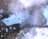
Pasadena CA (JPL) Aug 16, 2010 On Aug. 5, 2010, an enormous chunk of ice, about 251 square kilometers (97 square miles) in size, or roughly four times the size of Manhattan, broke off the Petermann Glacier along the northwestern coast of Greenland. The Petermann Glacier lost about one-quarter of its 70-kilometer-long (40-miles) floating ice shelf, according to researchers at the University of Delaware, Newark, Dela. The ... read more |
|
| The content herein, unless otherwise known to be public domain, are Copyright 1995-2010 - SpaceDaily. AFP and UPI Wire Stories are copyright Agence France-Presse and United Press International. ESA Portal Reports are copyright European Space Agency. All NASA sourced material is public domain. Additional copyrights may apply in whole or part to other bona fide parties. Advertising does not imply endorsement,agreement or approval of any opinions, statements or information provided by SpaceDaily on any Web page published or hosted by SpaceDaily. Privacy Statement |