 |
Washington DC (SPX) Jul 19, 2010 A small earthquake, centered in Germantown, Md. occurred at 5:04 a.m. EDT, July 16 and its vibrations were felt from West Virginia to Bridgeport, Conn. NASA's Goddard Space Flight Center located in Greenbelt, Md., lies about 25 miles east-southeast of the small earthquake and reported no damages. In fact, there were no reports of damage throughout Maryland. The earthquake registered 3.6 on the Richter scale, according to the U.S. Geological Survey (USGS), the agency that monitors quakes around the U.S. USGS reported that the quake occurred Friday, July 16, 2010 at 5:04:47 a.m. EDT. The quake originated 5 kilometers (3.1 miles) deep and it was centered at 39.167 degrees North, 77.252 degrees West, in Germantown, Md. That latitude and longitude positions the quake's epicenter just west of Interstate 270 and south of Maryland state route 119. The USGS noted that the epicenter was 15 km (10 miles) northwest of Rockville, Md., 30 km (15 miles) east-northeast of Leesburg, Va., 35 km (20 miles) northwest of Washington, D.C., and 70 km (45 miles) west-northwest of Annapolis, Md. Although earthquakes are monitored by the U.S. Geological Survey, NASA conducts research in various earthquake projects. That research is done in earthquake country, however, at NASA's Jet Propulsion Laboratory in Pasadena, Calif., just outside of Los Angeles. NASA measures, computes, and models crustal deformation using GPS and Interferometric Synthetic Aperture Radar (InSAR) from its airborne unmanned aerial vehicle (UAV) SAR platform and international satellites. "Crustal deformation occurs both as a result of earthquakes and quietly," said Andrea Donnellan, a geophysicist at NASA's Jet Propulsion Laboratory, Pasadena, Calif. and a research professor at the University of Southern California and NASA's Applied Sciences Program Area Co-Lead for Natural Disasters. "The quiet or aseismic motions provide insight into the processes that produce earthquakes. GPS data provide daily precise positions of points or stations on the ground, which in turn provide a detailed time history of crustal deformation and changes. InSAR provides regional images of crustal deformation." NASA funds several projects that integrate the GPS and InSAR data into models that provide insight into fault activity and earthquake potential, and Donnellan is the Principal Investigator of NASA's QuakeSim project, as well as supercomputing, earthquake modeling, and UAVSAR projects. Fortunately or unfortunately, depending on how you look at it, the quake was too small for NASA to detect. The last earthquake in the region occurred in May of 2008 and was even smaller, registering a magnitude of 2.0 on the Richter Scale.
Share This Article With Planet Earth
Related Links Report what you felt during earthquake events and view a map displaying accumulated data from your report and others Earth Observation News - Suppiliers, Technology and Application
 A Puzzling Collapse Of Earth's Upper Atmosphere
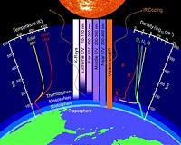
Huntsville AL (SPX) Jul 16, 2010 NASA-funded researchers are monitoring a big event in our planet's atmosphere. High above Earth's surface where the atmosphere meets space, a rarefied layer of gas called "the thermosphere" recently collapsed and now is rebounding again. "This is the biggest contraction of the thermosphere in at least 43 years," says John Emmert of the Naval Research Lab, lead author of a paper announcing ... read more |
|
| The content herein, unless otherwise known to be public domain, are Copyright 1995-2010 - SpaceDaily. AFP and UPI Wire Stories are copyright Agence France-Presse and United Press International. ESA Portal Reports are copyright European Space Agency. All NASA sourced material is public domain. Additional copyrights may apply in whole or part to other bona fide parties. Advertising does not imply endorsement,agreement or approval of any opinions, statements or information provided by SpaceDaily on any Web page published or hosted by SpaceDaily. Privacy Statement |