 |
Nairobi (AFP) Jan 21, 2010 Researchers on Friday launched an insurance scheme for Kenyan herders using satellite images to provide broader and fairer compensation for livestock losses. Launched in northern Kenya's pastoralist -- or livestock raising -- Marsabit region, the Index-Based Livestock Insurance (IBLI) uses vegetation images to estimate cattle mortality as a function of forage loss. Project leader Andrew Mude explained that the system will be an improvement on a compensation system based on costly damage assessment. "The transaction cost for normal insurance where they have to verify the claims and the truth of the claims would be too expensive," he told AFP. "Rather than verify losses, all you have to do is to look at the state of that index because it will give you a very good sense of what the condition is on the ground," he added. "A very good indicator of drought and of livestock mortality due to drought is the availability of pasture." Livestock is the key source of livelihood for the millions of residents in the east Africa country's arid northern regions which has witnessed 28 major droughts in the past 100 years. Four of those droughts occurred in the past decade. A prolonged dry spell last year decimated thousands of livestock in the region, leaving families to depend on aid. Under the scheme, developed jointly by the International Livestock Research Institute and a team of American university researchers, the insurance will cover losses in excess of 15 percent of the herd's value. Herders will be compensated for their cows, camels, sheep and goats whose value is calculated in units known as Tropical Livestock Unit (TLU). A cow is worth one TLU, a camel, 0.7 and 10 sheep or goats are equivalent to one TLU, which in turn is worth 12,000 shillings (160 dollars), the average local price for a cow. The pilot scheme targets between 500 and 1,000 households, said Mude, adding that it could help stabilise the income of some of the country's poorer communities.
Share This Article With Planet Earth
Related Links Earth Observation News - Suppiliers, Technology and Application
 NASA's ASTER Instrument Observes Haiti Quake Aftermath
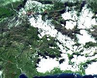
Pasadena CA (SPX) Jan 19, 2010 On January 14, 2010, the Advanced Spaceborne Thermal Emission and Reflection Radiometer (ASTER) instrument on NASA's Terra spacecraft captured this simulated natural color image of the Port-au-Prince, Haiti, area, two days after a magnitude 7.0 earthquake struck the region and caused massive damage and loss of life. While ASTER's 15-meter (50-foot) resolution is not sufficient to see damag ... read more |
|
| The content herein, unless otherwise known to be public domain, are Copyright 1995-2009 - SpaceDaily. AFP and UPI Wire Stories are copyright Agence France-Presse and United Press International. ESA Portal Reports are copyright European Space Agency. All NASA sourced material is public domain. Additional copyrights may apply in whole or part to other bona fide parties. Advertising does not imply endorsement,agreement or approval of any opinions, statements or information provided by SpaceDaily on any Web page published or hosted by SpaceDaily. Privacy Statement |