 |
Paris, France (ESA) Dec 15, 2009 In support of the United Nations Framework Convention on Climate Change taking place in Copenhagen, the European Environment Agency hosted the 'Bend the Trend' event on Sunday evening to provide a global climate networking platform and premiere the screening of the new 'Environmental Atlas of Europe'. The 'Environmental Atlas of Europe', a joint project of the European Environment Agency (EEA), the UN Environment Programme (UNEP) and ESA, is a series of short films showing the significance of environmental change depicted in comparisons of stunning satellite images through the years and the different ways people are responding to these changes. ESA provided a variety of up-to-date, captivating satellite images and products from various European satellites. These range from ship ice roads in the Baltic Sea to the river systems of Albania, from a gigantic plankton bloom off the Irish coast to the reduction of agricultural land in south-east Georgia. Each of these images will help to make the viewer understand the environmental, scientific and political issues we are facing today. Opening the event, EEA Executive Director Jacqueline McGlade said that ecosystem-accounting mechanisms are the only viable solution in the long term for protecting our environment and named satellite data as the unique comprehensive sources of ecosystem monitoring. She also said satellite data from ESA, including the future Sentinel missions whose data are expected to be open and freely accessible, will be crucial for ecosystem managers in Europe and worldwide. ESA's Director of Earth Observation Volker Liebig, who spoke at the event, said: "The advantages satellites offer are evident: only from space do we have a truly global view. Satellites fly over literally every corner of the surface of our planet. They measure diverse parameters, from sea surface temperatures to movements in the solid Earth, from gases in the atmosphere to land cover, and much more. They do this repeatedly, day and night, 24 hours a day, for years. The data we receive from space are a key contribution to the information we need to tackle climate change. "When we were invited to contribute to the atlas project, we said yes immediately. I am convinced that this atlas will bring our common ambitions closer to the people. Earth Observation from space is a scientific imperative, but it has also become a crucial tool for policy assessment and political decision-taking." It is important for various institutions and actors to work together to team efforts to match space-based data with local, or in-situ, data. Combining space-based measurements with in-situ measurements and other sources like historic weather records and maps help us to understand better climate change and to raise awareness. EEA is associated with the service development activities in the GMES (Global Monitoring for Environment and Security) programme. GMES is a joint programme run by the EC and ESA to develop European Earth-observation capacities and monitor climate change. ESA is responsible for the space component of GMES, and EEA is responsible for the in-situ component. There is a range of pledges to choose from, including using public transportation instead of cars, replacing a holiday return flight in Europe with recreation in your local region, reducing showers to five-minutes, changing to energy-saving light bulbs, eating meat-free meals three days per week, stopping the use of tumble dryers, reducing room temperatures by 1 degree, and drinking tap water rather than bottled. Dr Liebig has pledged to reduce travelling by organising and attending more video conferences in the coming year and to exchange the light bulbs in his house. Share This Article With Planet Earth
Related Links ESA Earth Observation News - Suppiliers, Technology and Application
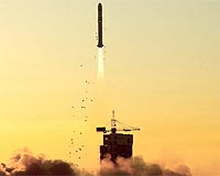
 China Launches Yaogan 7 Remote-Sensing Satellite
Jiuquan China (XNA) Dec 11, 2009 China launched Wednesday a remote-sensing satellite, "Yaogan VII," from the Jiuquan Satellite Launch Center in northwestern Gansu Province. The satellite was successfully launched into the space on a Long March 2D carrier rocket at 4:42 p.m., the center reported. It will be mainly used for scientific experiment, land resources survey, crop yield estimates and disaster prevention and ... read more |
|
| The content herein, unless otherwise known to be public domain, are Copyright 1995-2009 - SpaceDaily. AFP and UPI Wire Stories are copyright Agence France-Presse and United Press International. ESA Portal Reports are copyright European Space Agency. All NASA sourced material is public domain. Additional copyrights may apply in whole or part to other bona fide parties. Advertising does not imply endorsement,agreement or approval of any opinions, statements or information provided by SpaceDaily on any Web page published or hosted by SpaceDaily. Privacy Statement |