|
 Cartosat-2B To Become Operational In A Week
Chennai, India (PTI) Jul 15, 2010 Cartosat-2B - the remote-sensing satellite put in orbit by the Polar Satellite Launch Vehicle (PSLV-C15) on Monday - is in fine fettle and will become operational in a week. The rocket put four other satellites as well in orbit at an altitude of 637 km. "The health of the satellite is good. Everything has been checked out. It will become operational in a week's time," said P.S. Veeraraghavan, Director, Vikram Sarabhai Space Centre, Thiruvananthapuram. The images taken by Cartosat-2B's ... read more |
. |
|
|
Free Space, Earth, Energy And Military Newsletters - Delivered Daily |
| . | . |
 |
| .. |
LaBarge Awarded $1.2 M For RAM Guided Missile Launch System St. Louis MO (SPX) Jul 15, 2010
LaBarge, Inc. has received a $1.2 million contract from Raytheon Missile Systems to provide printed circuit card assemblies for the Rolling Airframe Missile (RAM) Guided Missile Weapon System. ''LaBarge has produced a variety of complex wiring harnesses for the RAM missile system for two decades. This new contract expands LaBarge's support of Raytheon's missile system to include electronic ... more India eyeing UCAVs in global market  New Delhi (UPI) Jul 13, 2010
 Indian armed forces have entered the global market in search of stealthy, unmanned combat air vehicles. Local news reports suggest that the military authorities have requested information from defense companies in Europe, Israel, the United States and Russia about the aircraft. Defense News reported that the information request concerned unmanned combat air vehicles with "low rad ... more Gilat To Provide Broadband Satellite For Homeland Security In Asia  Petah Tikva, Israel (SPX) Jul 14, 2010
Gilat Satellite Networks has been chosen to provide broadband satellite networks for homeland security applications in Asia. The networks are being used to deliver data, video and voice applications for homeland security and border patrol forces in addition to other defense requirements. The networks incorporate a video surveillance application and various quick-deploy transportable units. ... more |
.. |
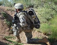
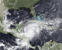
 Army Plans Network Integration Exercise  GOES Brings Hurricane Alley Live To The Wireless  Instant online solar energy quotes Solar Energy Solutions from ABC Solar |
.. |
|
|
Free Space, Earth, Energy And Military Newsletters - Delivered Daily |
|
|
. |
 Britain unveils Google Earth map showing temperature rises
London (AFP) July 14, 2010 British ministers on Wednesday launched a new Google Earth map designed to show the potential impact of temperature rises of four degrees Celsius. The interactive map lets members of the public see the dramatic changes that could occur if action is not taken to curb greenhouse gas emissions. Significant alterations include higher temperatures over land compared to the sea, and extreme temperature increases in the Arctic, according to the map. It was created using analysis from the Met Off ... read more |
| The contents herein, unless otherwise known to be public domain, are Copyright 1995-2010 - SpaceDaily. AFP and UPI Wire Stories are copyright Agence France-Presse and United Press International. ESA Portal Reports are copyright European Space Agency. All NASA sourced material is public domain. Additional copyrights may apply in whole or part to other bona fide parties. Advertising does not imply endorsement, agreement or approval of any opinions, statements or information provided by SpaceDaily on any web page published or hosted by SpaceDaily. Privacy statement |
| Previous Issues | Jul 14 | Jul 13 | Jul 12 | Jul 09 | Jul 08 |