 |
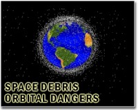
London, UK (SPX) Mar 08, 2011 UK space surveillance technology is being used in ESA's first co-ordinated space tracking campaign - part of a larger programme to provide up to date and accurate information on space hazards in Earth's orbit. These hazards stem from possible collisions between objects in orbit, harmful space weather and potential strikes by natural objects that cross Earth's orbit. UK involvement in the tracking campaign is through the UK Space Agency and includes Space Insight's Starbrook - an innovative optical sensor system for space surveillance, and the Science and Technology Facilities Council's Chilbolton Observatory - one of the world's most advanced meteorological radar experimental facilities. Organised as part of ESA's Space Situational Awareness preparatory programme, the campaign is designed to test the utility of existing telescopes and radars to observe objects in Earth orbit. As well as evaluating each of the individual sensors, it will check out interoperability issues and will provide input to the design of future ESA space surveillance capabilities. Professor Richard Crowther, a space debris expert from the UK Space Agency, said: "Space surveillance projects like this one are vital in this age of growing space technology. With more than 20 000 tracked objects including around 1000 operational satellites orbiting the Earth, we need to be aware of potential collisions. At closing speeds reaching 50 thousand km per hour, even the smallest bits of space debris can cause serious harm to spacecraft. This damage can have a massive impact on our lives, as we increasingly rely on space-based activity to provide us with many modern services." The UK signed up to ESA's Space Situational Awareness (SSA) programme at the 2008 Ministerial Council meeting. The programme is designed to provide a European source of information on space hazards and a satellite close-approach warning service - an important tool in the prevention of collisions and the resultant creation of more space debris. The dangers of such collisions have already been demonstrated by the Iridium / Cosmos collision in 2009. The data from Starbrook and STFC's Chilbolton Observatory is being used to refine orbital models, enabling more accurate predictions of a space object's future position. This has applications in the area of satellite collision avoidance and conjunction analysis which involves the prediction and post-event analysis of close approaches, or, in the worst case, collisions between two space objects. The Starbrook optical sensor is a ground-based wide field of view surveying sensor, designed by Space Insight Ltd to make feasible the task of observing the increasingly large number of objects in the higher Earth orbits, such as the geostationary and GPS-type orbits. It detects objects as small as 1m in size at up to 40,000km from Earth. Dr James Dick, Space Insight Ltd, said: "The Starbrook sensor uses highly sensitive digital imaging technology and wide field of view optics to deliver rapid surveying capability for space. Within Europe, we believe it is one of the most productive space surveillance sensors in terms of the numbers of objects located per night." The Chilbolton Advanced Meteorological Radar (CAMRa) comprises a high-powered transmitter and sensitive receiver installed on the 25 m diameter fully-steerable dish antenna at STFC's Chilbolton Observatory site in Hampshire, UK. The radar is able to track and characterise satellites in low earth orbit. Currently, objects with a radar cross-section of one square metre are detectable at ranges of 1000 km. In future, it is planned to modify the radar so as to characterise targets in more detail by exploiting their polarimetric and Doppler signatures. Dr Jon Eastment, responsible for the Space Surveillance radar programme at STFC's Chilbolton Observatory, said: "We have obtained very encouraging initial results during the recent ESA-sponsored campaign, having successfully tracked a variety of satellites at ranges out to over 2000 km. We are currently upgrading the system's hardware to improve its sensitivity, and look forward to participating in future Space Situational Awareness work for a variety of customers". ESA is in the process of designing its own space surveillance sensors, with a procurement phase expected after the next ESA Ministerial Council meeting scheduled in 2012. Until its own sensors are ready, ESA will continue to collect data from existing sensors of participating member states in order to test data processing and sensor tasking facilities.
Share This Article With Planet Earth
Related Links UK Space Agency Space Technology News - Applications and Research
 US, France to sign accord on tracking space debris
Washington (AFP) Feb 7, 2011 US and French defense chiefs plan to sign a space cooperation agreement on Tuesday designed to help track debris in outer space threatening vital satellites, officials told AFP. The accord follows the unveiling of a new US space security policy last week that calls for building a network of foreign partners to save costs and deter possible threats to sensitive satellites. The agreement w ... read more |
|
| The content herein, unless otherwise known to be public domain, are Copyright 1995-2010 - SpaceDaily. AFP and UPI Wire Stories are copyright Agence France-Presse and United Press International. ESA Portal Reports are copyright European Space Agency. All NASA sourced material is public domain. Additional copyrights may apply in whole or part to other bona fide parties. Advertising does not imply endorsement,agreement or approval of any opinions, statements or information provided by SpaceDaily on any Web page published or hosted by SpaceDaily. Privacy Statement |