 |
Potsdam, Germany (SPX) Sep 14, 2010 The complex fracture pattern created by the earthquake in Concepcion (Chile) on 27 February 2010 was to a certain extent predictable. GPS observations from the years before the earthquake showed the pattern of stresses that had accumulated through the plate movements during the past 175 years in this area. The stress distribution derived from the observations correlates highly with the subsequent fracture distribution. In all likelihood the tremor removed all the stress that had accumulated since the last earthquake in this region, which was observed by Charles Darwin in 1835. An earthquake of similar magnitude in this area is therefore unlikely in the near future. This result was presented by scientists of the GFZ German Centre for Geosciences (Helmholtz Association) in the latest edition of the scientific journal "Nature" (09 September 2010). "The Maule earthquake near Concepcion, Chile, on the 27 Februar registered with a momentum magnitude of 8.8, makes it one of the largest earthquakes to have been recorded in its entirety via a modern network of space-geodetic and geophysical instruments on the ground," says Professor Onno Oncken, head of the Depoartment "Geodynamics" at GFZ. "It thus offers a unique opportunity to compare detailed observations prior to the earthquake with those taken during and after it, and to re-evaluate hypotheses regarding the predictability of such events." Measurements using the satellite navigation system GPS showed that the seafloor of the Nazca plate in the Pacific Ocean does not slide evenly under the western boundary of the South American continent. Rather, it appears from the GPS measurements that some parts of the ocean floor got locked with the subsurface of the continent. In the gaps, however, the Nazca plate continued to push under South America. The resulting uneven stress pattern was released by the earthquake of the 27 February in such a way that, just like a zipper, the locked patches were ruptured one after the other. As a result, this seismic gap off the Chilean westcoast is now closed, one last gap remains in northern Chile. Here, the GFZ scientists set up a plate boundary observatory, in order to make use of the entire range of geoscientific instruments to record the conditions before, during and after an earthquake- an important step in understanding the processes of plate tectonics. Modern Earth science may still not be able to predict the location, time and magnitude of an earthquake. But the present study offers an optimistic perspective concerning the predictability of possible fracture patterns and magnitudes of expected earthquakes.
Share This Article With Planet Earth
Related Links GFZ German Centre for Geosciences (Helmholtz Association) Earth Observation News - Suppiliers, Technology and Application
 Satellite Data Reveal Seasonal Pollution Changes Over India
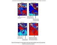
Champaign IL (SPX) Sep 13, 2010 Armed with a decade's worth of satellite data, University of Illinois atmospheric scientists have documented some surprising trends in aerosol pollution concentration, distribution and composition over the Indian subcontinent. In addition to environmental impact, aerosol pollution, or tiny particles suspended in the air, can be detrimental to human health by causing a range of respiratory ... read more |
|
| The content herein, unless otherwise known to be public domain, are Copyright 1995-2010 - SpaceDaily. AFP and UPI Wire Stories are copyright Agence France-Presse and United Press International. ESA Portal Reports are copyright European Space Agency. All NASA sourced material is public domain. Additional copyrights may apply in whole or part to other bona fide parties. Advertising does not imply endorsement,agreement or approval of any opinions, statements or information provided by SpaceDaily on any Web page published or hosted by SpaceDaily. Privacy Statement |