 |
Bonn, Germany (SPX) Jun 29, 2009 The image, taken by the German radar satellite TerraSAR-X, shows the volcano 'Piton de la Fournaise' (Furnace Peak) in the south of the island of La Reunion (Indian Ocean). This is the last active volcano on the island and is 2631 metres high. By means of very precise repeat-pass interferometric measurements, TerraSAR-X is able to detect even small movements of the Earth's surface, thus supporting volcano monitoring. The image was taken on 5 June 2008. It was acquired in spotlight mode with a resolution of two metres. It covers an area of 11�10 kilometres.
The TerraSAR-X mission The satellite travels around the Earth in a polar orbit and records unique, high-quality X-band radar data about the entire planet using its active antenna. TerraSAR-X works regardless of weather conditions, cloud cover or absence of daylight, and is able to provide radar data with a resolution of down to one metre per pixel. DLR is responsible for using TerraSAR-X data for scientific purposes. It is also responsible for planning and implementing the mission as well as controlling the satellite. Astrium built the satellite and shares the costs of developing and using it. Infoterra GmbH, a subsidiary company founded specifically for this purpose by Astrium, is responsible for marketing the data commercially. Share This Article With Planet Earth
Related Links German Aerospace Center (DLR) Earth Observation News - Suppiliers, Technology and Application
 GOES-O Reaches Orbit
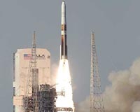
Cape Canaveral FL (SPX) Jun 29, 2009 The GOES-O satellite lifted off from Launch Complex 37 at Cape Canaveral Air Force Station in Florida at 6:51 p.m. EDT atop a Delta IV rocket. From a position about 22,300 miles above Earth, the advanced weather satellite will keep an unblinking eye on atmospheric conditions in the Eastern United States and Atlantic Ocean. The GOES-O weather satellite is on its own following a successful ... read more |
|
| The content herein, unless otherwise known to be public domain, are Copyright 1995-2009 - SpaceDaily. AFP and UPI Wire Stories are copyright Agence France-Presse and United Press International. ESA Portal Reports are copyright European Space Agency. All NASA sourced material is public domain. Additional copyrights may apply in whole or part to other bona fide parties. Advertising does not imply endorsement,agreement or approval of any opinions, statements or information provided by SpaceDaily on any Web page published or hosted by SpaceDaily. Privacy Statement |