 |
Pasadena, Calif. (UPI) Jun 2, 2009 U.S. space agency says it will provide satellite data for storm forecasts during the 2009 Atlantic and eastern Pacific hurricane seasons. The National Oceanic and Atmospheric Administration's National Hurricane Center is responsible for forecasting eastern Pacific and Atlantic tropical cyclones -- the generic name for hurricanes, typhoons, tropical storms and tropical depressions. NASA has several satellites in orbit that collect data vital for issuing accurate hurricane predictions. Data include storm and surface winds, sea surface heights and temperatures, rainfall intensity, lightning, cloud heights and temperatures, humidity and atmospheric pressure. NOAA's preliminary forecast calls for an average, "near normal" Atlantic hurricane season and William Patzert of NASA's Jet Propulsion Laboratory in Pasadena, Calif., said he sees merit in the cautionary prediction. "It is the beginning of a long summer and oceanic and atmospheric conditions can change dramatically," Patzert said, adding being vigilant and preparing for a major hurricane is still the best way to prepare for any hurricane season. "Along hurricane-prone coasts and areas, be ready; you can be clobbered no matter what the expert outlook is today," said Patzert. Share This Article With Planet Earth
Related Links Earth Observation News - Suppiliers, Technology and Application
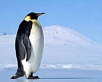
 Satellite poop trail leads way to Antarctic penguins
London (AFP) June 2, 2009 Scientists have tracked down previously undiscovered colonies of Antarctic emperor penguins after spotting trails of their droppings on satellite pictures, a study said Tuesday. Zooming in on individual penguins is beyond current satellite imagery, but the tell-tale reddish-brown stains on the polar ice helped hone in on large groups of the black and white flightless birds. Mapping exper ... read more |
|
| The content herein, unless otherwise known to be public domain, are Copyright 1995-2009 - SpaceDaily. AFP and UPI Wire Stories are copyright Agence France-Presse and United Press International. ESA Portal Reports are copyright European Space Agency. All NASA sourced material is public domain. Additional copyrights may apply in whole or part to other bona fide parties. Advertising does not imply endorsement,agreement or approval of any opinions, statements or information provided by SpaceDaily on any Web page published or hosted by SpaceDaily. Privacy Statement |