 |
London, UK (SPX) Dec 10, 2010 A group of researchers at MIT, Cornell University and University College London have used one of the world's largest databases of telecommunications records to redraw the map of Great Britain. The research, which will be published in the journal PLoS ONE, is based on the analysis of 12 billion anonymized records representing more than 95% of Great Britain's residential and business landlines. "Since the pioneering work of Christaller and Losch in the early 20th century, a long-standing question in economic geography has been how to define regions in space," explains Carlo Ratti, director of the MIT SENSEable City Lab and one of the paper's authors. "Our paper proposes a novel, fine-grained approach to regional delineation, based on analyzing networks of billions of individual human transactions." Given a geographical area and some measure of the strength of links between its inhabitants, the paper describes mathematically how to partition the area into smaller, non-overlapping regions while minimizing the disruption to each person's links. For the most part, the results of the partitioning correspond remarkably well with existing administrative regions, but they still unveil some unexpected spatial structures. "We have discovered a new region just west of London which corroborates an earlier hypothesis of a 'western crescent' centered on high-tech activities," explains the Francesco Calabrese, one of the paper's authors. Wales, and to a lesser extent Yorkshire, also seem to have been incorporated into regions dominated by the major cities of the West and East Midlands regions, respectively. "The difference between Scotland and Wales is striking," adds Ratti. "Based on our landline data, Scotland is very separated from the rest of Great Britain: just 23.3% of all call time placed or received there goes to or comes from another part of the country. Conversely, Wales, in spite of its unique cultural and linguistic heritage, is well integrated with its English neighbors to the East." It's unlikely, of course, that Wales and England are going to merge anytime soon, so the discovery that several Welsh cities seem to depend heavily on the exchange of information with nearby English cities, and vice versa, probably won't have major political consequences. But, Ratti says, the value of the new work is that it shows that analyzing information flow could be a useful tool in the drawing of political boundaries. And, he says, it will only become more useful as data from other networks - the Internet, Internet telephone networks, instant-messaging networks - become available for analysis. The paper's approach belongs to an emerging field that has been recently termed "computational social sciences" - i.e., the ability to address social-science research questions using huge datasets that have emerged over the past decades as a result of digitalization. "We are particularly interested in how rich data at the individual level can promote a better understanding of our society, which, in the future, could lead to more democratic, bottom-up structures of governance," adds Calabrese. "Very little in network theory has been done, believe it or not, on networks in geographical Euclidean space," says coauthor Professor Steven Strogatz, one of the pioneers of network science. "In reality, on top of the pure topology of who is connected to whom is the structure of actual distances. I think that the analysis of spatial networks, as in this paper, could be a really important area in the next few years." Ratti C, Sobolevsky S, Calabrese F, Andris C, Reades J, et al. (2010) Redrawing the Map of Great Britain from a Network of Human Interactions. PLoS ONE 5(12): e14248. doi:10.1371/journal.pone.0014248
Share This Article With Planet Earth
Related Links Public Library of Science Earth Observation News - Suppiliers, Technology and Application
 NASA Satellite Sees An Early Meteorological Winter In US Midwest
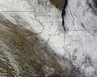
Greenbelt MD (SPX) Dec 10, 2010 NASA's Terra satellite captures daily visible and infrared images around the Earth and took a daytime image of a blanket of snow in the Upper Midwest this week. Even though astronomical winter is less than two weeks away, the central and eastern U.S. are already experiencing meteorological winter. Meteorological winter is basically an identification of the winter season based on "sensible ... read more |
|
| The content herein, unless otherwise known to be public domain, are Copyright 1995-2010 - SpaceDaily. AFP and UPI Wire Stories are copyright Agence France-Presse and United Press International. ESA Portal Reports are copyright European Space Agency. All NASA sourced material is public domain. Additional copyrights may apply in whole or part to other bona fide parties. Advertising does not imply endorsement,agreement or approval of any opinions, statements or information provided by SpaceDaily on any Web page published or hosted by SpaceDaily. Privacy Statement |