 |
Greenbelt MD (SPX) Jun 04, 2010 NASA's Tropical Rainfall Measuring Mission and Aqua satellites are keeping a close eye on Cyclone Phet, a monster cyclone in the Arabian Sea, now affecting coastal Oman. Cyclone Phet's winds and heavy rains reached Oman's east coast earlier, June 3. Authorities in Oman have raised the threat level to orange, and evacuations have already taken place. Yesterday, when Phet was powering up from a Category three to a Category four cyclone on the Saffir-Simpson scale, the Tropical Rainfall Measuring Mission or TRMM satellite traveled almost directly above Phet in the Arabian Sea. On June 2 at 0140 UTC (June 1 at 9:40 p.m. EDT) TRMM data showed that numerous powerful thunderstorms were imbedded in Phet's well defined eye wall. They were producing very heavy rainfall of over 50 mm/hr (~2 inches). That rainfall is affecting the coast of Oman. At 0900 UTC (5 a.m. EDT), June 3, Cyclone Phet (a Category 4 storm on the Saffir-Simpson scale) was located about 275 nautical miles south of Muscat, Oman, near 19.2 North and 59.3 East. Phet's maximum sustained winds were near 115 knots (132 mph) with gusts to 140 knots (161 mph). Phet has moved on a north-northwestward track at 4 knots (5 mph). Phet is creating extremely dangerous seas along the coast of Oman, with waves as high as 30 feet, so all fishing and other boats have been warned not to venture to sea. Forecasters at the Joint Typhoon Warning Center using animated multispectral imagery noted this morning that the imagery indicates the system has regained a 20-nautical mile wide ragged eye that appeared to wobble as the cyclone underwent a possible eye-wall replacement. The Atmospheric Infrared Sounder (AIRS) on NASA's Aqua satellite captured an infrared image of Cyclone Phet on June 3 at 08:59 UTC (4:59 a.m. EDT) in which the western half of the storm was already on top of coastal Oman. It showed a large area of strong thunderstorms with high, cold cloud tops as cold as -63 Fahrenheit. Phet is in an area of low vertical wind shear. Vertical wind shear means winds blowing at different directions at different levels in the atmosphere that can tear a storm apart. When vertical wind shear is strong, it weakens tropical cyclones. When wind shear is weak, it allows tropical cyclones to maintain or increase intensity. Water vapor imagery from satellites do indicate that as Phet continues moving through the Arabian Sea, it will encounter dry air, which will help weaken the cyclone. The friction of the storm raking over the Oman coast will also contribute to weakening the cyclone. After skirting the Oman coast, Phet is expected to swing eastward and make landfall just north of Karachi, Pakistan.
Share This Article With Planet Earth
Related Links Goddard Space Flight Center Earth Observation News - Suppiliers, Technology and Application
 NASA Images Show Oil's Invasion Along Louisiana Coast
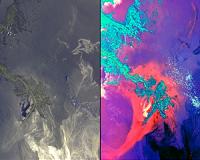
Pasadena CA (JPL) Jun 04, 2010 These images, acquired on May 24, 2010 by the Multi-angle Imaging SpectroRadiometer (MISR) instrument aboard NASA's Terra spacecraft, show the encroachment of oil from the former Deepwater Horizon rig into Louisiana's wildlife habitats. The source of the spill is located off the southeastern (bottom right) edge of the images. Dark filaments of oil are seen approaching the shores of Blind B ... read more |
|
| The content herein, unless otherwise known to be public domain, are Copyright 1995-2010 - SpaceDaily. AFP and UPI Wire Stories are copyright Agence France-Presse and United Press International. ESA Portal Reports are copyright European Space Agency. All NASA sourced material is public domain. Additional copyrights may apply in whole or part to other bona fide parties. Advertising does not imply endorsement,agreement or approval of any opinions, statements or information provided by SpaceDaily on any Web page published or hosted by SpaceDaily. Privacy Statement |