 |
Greenbelt MD (SPX) Nov 25, 2010 The GOES-13 satellite captured a look at the cloud cover and weather systems around the U.S. on Nov. 24 as Thanksgiving travelers make their way to their holiday celebrations. With six days left in the Atlantic and Eastern Pacific Ocean hurricane season there is not a tropical cyclone in sight. The Geostationary Operational Environmental Satellite (GOES) series of satellites are operated by the National Oceanic and Atmospheric Administration. NASA's GOES Project, located at NASA's Goddard Space Flight Center, Greenbelt, Md. creates some of the satellite images and animations from the GOES satellites. The GOES-13 satellite captured an image of North America on Wednesday, November 24 at 1445 UTC (9:45 a.m. EST) showing a large area of cloud cover stretching from the Gulf coast north into the upper Midwest. That cloud cover is associated with a warm front that stretches from the Tennessee Valley west to Kansas where an associated low pressure area is located. Residents the in the Tennessee and Ohio valleys can expect rain from that system, and severe storms are possible in Missouri, northern Arkansas and eastern Kansas and eastern Oklahoma today. Ahead of the large blanket of cloud cover, high pressure is currently keeping the U.S. east coast in sunshine, but that will change as the clouds track east by Thanksgiving Day. Behind the blanket of cloud cover appears to be a long line of clouds from south to north that resembles an exclamation mark. Those are clouds associated with a front that's bringing snow to Minnesota, the Dakotas, western Montana, Wyoming, Colorado, northern Arizona and eastern Utah today. Snows in North Dakota and the Colorado Rockies may be heavy. To the west of that line of clouds there is a high pressure system centered over northern Nevada which will bring mostly clear conditions to Washington, Oregon, Idaho, Nevada, and California.
Share This Article With Planet Earth
Related Links Updated GOES satellite animations of weather systems in the eastern U.S Updated GOES satellite animations of weather systems in the western half of the U.S Earth Observation News - Suppiliers, Technology and Application
 Express Map Delivery From Space
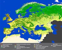
Paris, France (ESA) Nov 24, 2010 Meeting the environmental needs of an ever-expanding Europe requires consistent and regularly updated information on its land cover and use. As part of ESA's GlobCorine project, a pan-European land cover and use map for 2009 is now available online. The map, based on ESA's Envisat MERIS data from 1 January to 31 December 2009, is the first of its kind to be produced in such a short time - ... read more |
|
| The content herein, unless otherwise known to be public domain, are Copyright 1995-2010 - SpaceDaily. AFP and UPI Wire Stories are copyright Agence France-Presse and United Press International. ESA Portal Reports are copyright European Space Agency. All NASA sourced material is public domain. Additional copyrights may apply in whole or part to other bona fide parties. Advertising does not imply endorsement,agreement or approval of any opinions, statements or information provided by SpaceDaily on any Web page published or hosted by SpaceDaily. Privacy Statement |