 |
Greenbelt MD (SPX) Jan 04, 2011 Cyclone Tasha recently made landfall just south of Cairns along the northeast coast of Queensland, Australia during the early morning hours on Christmas Day. The storm, which had formed just off the coast, came ashore as a Category 1 cyclone (equivalent to a tropical storm on the U.S. Saffir-Simpson scale) with wind gusts of up to 105 kph (~65 mph) reported just offshore. The Tropical Rainfall Measuring Mission satellite (known as TRMM) was launched back in 1997 with the primary purpose of measuring rainfall in the Tropics. With its unique combination of active radar and passive microwave sensors, TRMM has also served as a valuable platform for monitoring tropical cyclones. TRMM captured an image of Tasha at 15:32 UTC (5:32 am AEST) on the 24th of December 2010 just before it became a Category 1 cyclone. Tasha appears as an area of enhanced rainfall with moderate to localized areas of heavy rain embedded within a broader area of light to moderate rain draped along the coast of northeastern Australia. Tasha has no eye and little evidence of banding, which indicates that it is not an intense system. In fact, Tasha's winds did little damage and the storm was quickly downgraded from a cyclone by the Australian Bureau of Meteorology's Tropical Cyclone Warning Centre; however, heavy rains from the storm and its remnants had a substantial impact on the region by exacerbating flood conditions already in place as a result of prior excessive rainfall across eastern Australia. The result was widespread flooding with many areas cut off. For increased coverage, TRMM can be used to calibrate rainfall estimates from other satellites. The TRMM-based, near-real time Multi-satellite Precipitation Analysis (TMPA) at the NASA Goddard Space Flight Center in Greenbelt, Md. is used to monitor rainfall over the global Tropics. TMPA rainfall totals were calculated for the period Dec. 1 to 29, 2010 for northeastern Australia and the surrounding region. Rainfall totals for the period exceed 300 mm (~12 inches) all along the northeast and northern coasts. Farther inland amounts drop off but still exceed 100 to 200 mm (~4 to 8 inches) over much of Queensland. Although Tasha is responsible for dumping a lot of the rain over a short period (the Bureau had a report of up to 10 inches in 24 hours as a result of Tasha), eastern Australia had already been experiencing above normal rainfall as result of above normal ocean temperatures in the West Pacific due to La Nina. La Nina, the counterpart to El Nino, occurs when enhanced trade winds pile up warmer-than-normal waters in the West Pacific while cooler-than-normal sea surface temperatures occur in the East Pacific. This leads to enhanced evaporation over the warmer water in the West Pacific with the excess moisture carried along by stronger-than-normal trade winds. The result is enhanced rainfall over the Maritime continent and northern and northeastern Australia during Northern Hemisphere winter (Southern Hemisphere summer) and drier-than-normal conditions over the Central and East Pacific. TMPA rainfall anomalies for the month of December 2010 for the tropical Pacific and surrounding region were constructed by first computing the average rainfall rate over the period and then subtracting the 10-year average rate for the same period. The resulting pattern shows a classic La Nina signature with above-normal areas of rain (shown in green and blue) over the Maritime continent and northeastern Australia and below-normal areas of rain (shown in brown over the Central Pacific. The estimated property damage from all the flooding in eastern Australia, which by some accounts is the worst in 50 years, is expected to exceed $1 billion.
Share This Article With Planet Earth
Related Links NASA Goddard Space Flight Center Earth Observation News - Suppiliers, Technology and Application
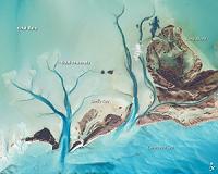
 Tidal Flats And Channels, Long Island, Bahamas
Washington DC (SPX) Jan 04, 2011 The islands of the Bahamas are situated on large depositional platforms-the Great and Little Bahama Banks-composed mainly of carbonate sediments ringed by reefs. The islands are the only parts of the platform currently exposed above sea level. The sediments were formed mostly from the skeletal remains of organisms settling to the sea floor; over geologic time, these sediments consolidated ... read more |
|
| The content herein, unless otherwise known to be public domain, are Copyright 1995-2010 - SpaceDaily. AFP and UPI Wire Stories are copyright Agence France-Presse and United Press International. ESA Portal Reports are copyright European Space Agency. All NASA sourced material is public domain. Additional copyrights may apply in whole or part to other bona fide parties. Advertising does not imply endorsement,agreement or approval of any opinions, statements or information provided by SpaceDaily on any Web page published or hosted by SpaceDaily. Privacy Statement |