 |
Beijing (UPI) Aug 24, 2010 China launched an Earth mapping satellite into polar orbit Tuesday, official Chinese media outlets said. The state-run Xinhua news agency said the Tianhui 1 satellite entered orbit more than 300 miles above Earth after launch atop a Long March 2D booster, SPACE.com reported. The launch of the 13-story booster took place at the Jiuquan space facility near the border of northern China's Inner Mongolia and Gansu provinces. Chinese Ministry of Defense authorities said Tianhui 1 would be used for scientific research, mapping and land resource surveys to help promote economic development. Tuesday's mission was the seventh Chinese space launch of the year and the 40th rocket overall in the world to reach orbit in 2010, SPACE.com said. It was the 13th mission for a Long March 2D rocket since 1992.
Share This Article With Planet Earth
Related Links Earth Observation News - Suppiliers, Technology and Application
 Processing Of First TanDEM-X Data Received At Inuvik
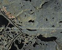
Bonn, Germany (SPX) Aug 23, 2010 Erhard Diedrich, in charge of the building of the Inuvik satellite station, returned from Canada with his colleagues, a happy man. The inauguration on 10 August was not only moving, but also marked the end of a successful first checkout phase. Over 300 passes of data have been acquired since April this year, among them 60 from the TanDEM-X satellite. We acquired a first image over the Inuv ... read more |
|
| The content herein, unless otherwise known to be public domain, are Copyright 1995-2010 - SpaceDaily. AFP and UPI Wire Stories are copyright Agence France-Presse and United Press International. ESA Portal Reports are copyright European Space Agency. All NASA sourced material is public domain. Additional copyrights may apply in whole or part to other bona fide parties. Advertising does not imply endorsement,agreement or approval of any opinions, statements or information provided by SpaceDaily on any Web page published or hosted by SpaceDaily. Privacy Statement |