 |
Beijing (XNA) Nov 08, 2010 Chinese Minister for Science and Technology Wan Gang has called for more international cooperation to boost research capabilities and the level of earth observation in developing countries. Cooperative efforts under the framework of the Global Earth Observation System of Systems (GEOSS) will help achieve the strategic targets set in the GEOSS's 10-Year Implementation Plan by 2015, Wan said at the Group on Earth Observations (GEO) Beijing Ministerial Summit here Friday. Earth observations are efforts to monitor and collect information on the status of the geology, meteorology, and biology of the earth. According to the GEO, earth observations help in disaster management, health, energy, climate, water, weather, ecosystems, agriculture and biodiversity. About 500 minister-level officials and delegates from 50 countries and 40 international organizations attended the meeting. The Chinese government hopes that GEO will make more efforts to promote the sharing of earth observation data, Wan said. At the meeting, David Hayes, deputy secretary of the Department of the Interior of the United States, said the U.S. will launch a new global initiative to develop a database of 30-meter satellite imagery to show changes in land cover and land use worldwide. Founded in 2005, the GEO is an intergovernmental international organization for earth observation. China had donated satellite dishes to 17 developing countries to share data from China's Fengyun meteorological satellite network, Wan said. China successfully launched a new meteorological satellite, the second of the Fengyun-3 (FY-3) series, early Friday morning.
Source: Source: Xinhua
Share This Article With Planet Earth
Related Links Global Earth Observation System of Systems (GEOSS) Earth Observation News - Suppiliers, Technology and Application
 Use Satellites To Know Your Snow
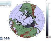
Paris, France (ESA) Nov 08, 2010 As winter approaches, northern dwellers will get assistance from space to help them face the harsh weather. Satellite information on snow cover is now available through ESA's GlobSnow project soon after it snows. As well as posing a hazard to communities through transportation shutdowns and floods, snow cover is one of the most important elements influencing the planet's climate, meteorolo ... read more |
|
| The content herein, unless otherwise known to be public domain, are Copyright 1995-2010 - SpaceDaily. AFP and UPI Wire Stories are copyright Agence France-Presse and United Press International. ESA Portal Reports are copyright European Space Agency. All NASA sourced material is public domain. Additional copyrights may apply in whole or part to other bona fide parties. Advertising does not imply endorsement,agreement or approval of any opinions, statements or information provided by SpaceDaily on any Web page published or hosted by SpaceDaily. Privacy Statement |